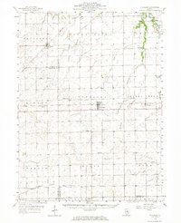
1958 Map of Flanagan
USGS Topo · Published 1967About this map
The agrarian landscape of Central Illinois is deeply documented here, centered on the village of Flanagan and the surrounding townships. During the late 1950s, this region was defined by a grid of farm roads and a network of small country churches and cemeteries, such as St Peters Ch and Springer Cem, which anchored the rural community. The Atchison Topeka and Santa Fe railroad cuts across the northwest corner near Dana, while the Illinois Central serves the heart of the territory, passing through Graymont.
Find a feature on this map
50 named features on this map. Tap any name to fly to it.
Don’t see what you’re looking for? This feature index may not catch every label — zoom into the map to look around manually.
Map Details
Editions of this 1958 Flanagan Map
2 editions found

Other maps of this area

1925 · Streator
USGS Topo · 1:62,500

1926 · Normal
USGS Topo · 1:62,500

1927 · Streator
USGS Topo · 1:62,500

1927 · Danvers
USGS Topo · 1:62,500

1930 · Danvers
USGS Topo · 1:62,500

1930 · Normal
USGS Topo · 1:62,500

1934 · Wenona
USGS Topo · 1:48,000

1935 · Pontiac
USGS Topo · 1:62,500

1939 · Pontiac
USGS Topo · 1:62,500

1939 · Wenona
USGS Topo · 1:62,500