
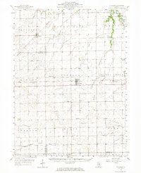
1958 Map of Flanagan
USGS Topo · Published 1959About this map
Flanagan serves as a central hub in this agricultural landscape of north-central Illinois, situated where the Illinois Central railroad intersects with state transit routes. The late 1950s terrain reveals a community infrastructure deeply rooted in its rural townships, including Nebraska, Rooks Creek, and Waldo. Local genealogy is well-preserved through numerous landmark churches and cemeteries, such as Nigh Chapel and the Salem Childrens Home. The drainage pattern is defined by several waterways, including the Vermilion River in the northeast and the winding path of Panther Creek to the south. Smaller hamlets like Dana and Graymont follow the established rail lines, illustrating the 19th-century transport network that still dictated the region's geography at the time of this 1958 survey.
Find a feature on this map
50 named features on this map. Tap any name to fly to it.
Don’t see what you’re looking for? This feature index may not catch every label — zoom into the map to look around manually.
Map Details
Editions of this 1958 Flanagan Map
2 editions found
Other maps of this area

1925 · Streator
USGS Topo · 1:62,500

1926 · Normal
USGS Topo · 1:62,500

1927 · Streator
USGS Topo · 1:62,500

1927 · Danvers
USGS Topo · 1:62,500

1930 · Danvers
USGS Topo · 1:62,500

1930 · Normal
USGS Topo · 1:62,500

1934 · Wenona
USGS Topo · 1:48,000

1935 · Pontiac
USGS Topo · 1:62,500

1939 · Pontiac
USGS Topo · 1:62,500

1939 · Wenona
USGS Topo · 1:62,500