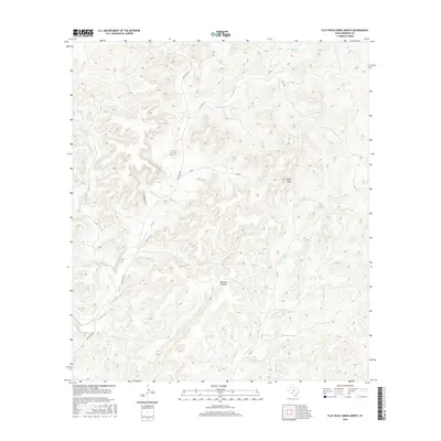
2016 Map of Flat Rock Creek North
USGS Topo · Published 2016About this map
Sycamore Cr and Flat Rock Cr wind through this corner of Edwards County, carving out a complex drainage system across the Texas Hill Country. The terrain is defined by prominent landmarks such as Indian Gap and the deep incision of Maurice Canyon, which together illustrate the dramatic vertical relief of the Edwards Plateau. While the area remains primarily open rangeland, a network of rural routes including Ranch Rd 2523 and various county roads like Co Rd 264 and Co Rd 27 provide access to the interior. This 2016 survey reflects the persistent character of a landscape where cattle ranching and natural geography dictate the pattern of human presence, with few formal settlements but many named topographic features used by locals to navigate the canyonlands.
Find a feature on this map
10 named features on this map. Tap any name to fly to it.
Don’t see what you’re looking for? This feature index may not catch every label — zoom into the map to look around manually.
Map Details
Editions of this 2016 Flat Rock Creek North Map
This is the sole edition of this map. No revisions or reprints were ever made.
Other maps of this area

1893 · Nueces
USGS Topo · 1:125,000

1896 · Nueces
USGS Topo · 1:125,000

1943 · Carta Valley
USGS Topo · 1:62,500

1944 · Flat Rock
USGS Topo · 1:62,500

1944 · Indian Creek
USGS Topo · 1:62,500

1944 · Indian Mountain
USGS Topo · 1:62,500

1958 · Del Rio
USGS Topo · 1:250,000

1964 · Del Rio
USGS Topo · 1:250,000
1974 · Twomile Draw
USGS Topo · 1:24,000
1974 · Kickapoo Caverns
USGS Topo · 1:24,000