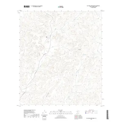
2019 Map of Flat Rock Creek North
USGS Topo · Published 2019About this map
Martin Ranch Airport serves as a lone landmark in this deeply dissected portion of Edwards County, where the Edwards Plateau breaks into a complex network of drainages. The landscape is defined by the winding course of Sycamore Cr in the north and west, while Flat Rock Cr carves through the southeast. Significant topographical features like Indian Gap and the steep-walled Maurice Canyon illustrate the challenging terrain that shaped early ranching and transportation in this part of West Texas. A limited network of secondary roads, including Ranch Rd 2523, Cr 650, and Cr 630, traces the natural contours of the hills, connecting isolated ranching outposts across the limestone breaks. This survey captures the rural character of the county before modern developments altered these traditional land-use patterns.
Find a feature on this map
11 named features on this map. Tap any name to fly to it.
Don’t see what you’re looking for? This feature index may not catch every label — zoom into the map to look around manually.
Map Details
Editions of this 2019 Flat Rock Creek North Map
This is the sole edition of this map. No revisions or reprints were ever made.
Other maps of this area

1893 · Nueces
USGS Topo · 1:125,000

1896 · Nueces
USGS Topo · 1:125,000

1943 · Carta Valley
USGS Topo · 1:62,500

1944 · Flat Rock
USGS Topo · 1:62,500

1944 · Indian Creek
USGS Topo · 1:62,500

1944 · Indian Mountain
USGS Topo · 1:62,500

1958 · Del Rio
USGS Topo · 1:250,000

1964 · Del Rio
USGS Topo · 1:250,000
1974 · Twomile Draw
USGS Topo · 1:24,000
1974 · Kickapoo Caverns
USGS Topo · 1:24,000