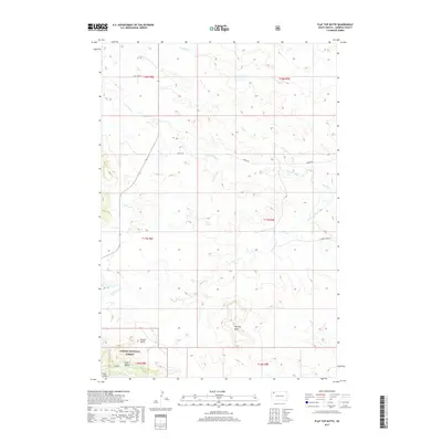
2017 Map of Flat Top Butte
USGS Topo · Published 2017About this map
Custer National Forest anchors the southwestern corner of this quadrangle, where the distinct landforms of the Slim Buttes and Finger Butte rise above the surrounding plains. The landscape is defined by a network of drainage systems including Rabbit Cr and Dog Cr, which dictate the local topography and the placement of rural corridors like Sorum Rd. The eponymous Flat Top Butte serves as a central landmark in this part of Harding County, providing a clear view of the transition from open range to more complex geological features. Near the southern boundary, Coal Gulch suggests the geological character of the region, while labels such as Point Comfort indicate localized water features or historical landmarks used by early ranchers and land managers navigating the high plains.
Find a feature on this map
19 named features on this map. Tap any name to fly to it.
Don’t see what you’re looking for? This feature index may not catch every label — zoom into the map to look around manually.
Map Details
Editions of this 2017 Flat Top Butte Map
This is the sole edition of this map. No revisions or reprints were ever made.
Other maps of this area

1935 · Reva
USGS Topo · 1:125,000

1935 · Hoover
USGS Topo · 1:125,000

1954 · Lemmon
USGS Topo · 1:250,000

1957 · Lemmon
USGS Topo · 1:250,000

1968 · Irish Butte
USGS Topo · 1:24,000

1968 · J B Hill
USGS Topo · 1:24,000

1968 · Reva
USGS Topo · 1:24,000

1968 · Sheep Mountain
USGS Topo · 1:24,000

1968 · Flat Top Butte
USGS Topo · 1:24,000

1969 · Battleship Rock
USGS Topo · 1:24,000