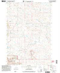
2005 Map of Flat Top Butte
USGS Topo · Published 2007About this map
Flat Top Butte dominates this landscape in Harding County, where the plains give way to the prominent elevations of the Slim Buttes and Custer National Forest. The map documents a sparse ranching environment at the turn of the 21st century, centered around isolated homesteads like Verhulst Ranch and Waldie Ranch. A network of seasonal watercourses including Dog Creek, Crooked Creek, and Rabbit Creek carve through the terrain, while the north-south Hoover Road provides the primary transit artery. Surveyors' markers such as the First Guide Meridian East and the Fourth Standard Parallel North segment the land, providing a glimpse into the orderly township and range system that continues to define this Western landscape.
Find a feature on this map
20 named features on this map. Tap any name to fly to it.
Don’t see what you’re looking for? This feature index may not catch every label — zoom into the map to look around manually.
Map Details
Editions of this 2005 Flat Top Butte Map
This is the sole edition of this map. No revisions or reprints were ever made.
Other maps of this area

1935 · Reva
USGS Topo · 1:125,000

1935 · Hoover
USGS Topo · 1:125,000

1954 · Lemmon
USGS Topo · 1:250,000

1957 · Lemmon
USGS Topo · 1:250,000

1968 · Irish Butte
USGS Topo · 1:24,000

1968 · J B Hill
USGS Topo · 1:24,000

1968 · Reva
USGS Topo · 1:24,000

1968 · Sheep Mountain
USGS Topo · 1:24,000

1968 · Flat Top Butte
USGS Topo · 1:24,000

1969 · Battleship Rock
USGS Topo · 1:24,000