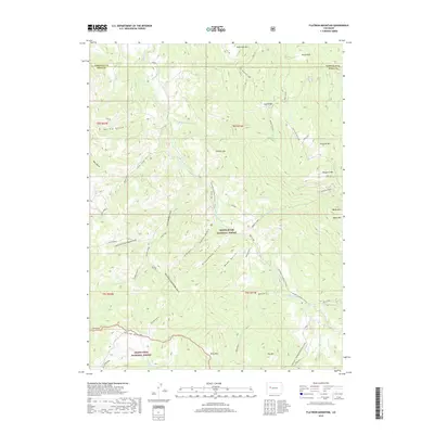
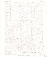
2019 Map of Flatiron Mountain
USGS Topo · Published 2019About this map
White River National Forest and Grand Mesa National Forest dominate this high-altitude landscape in Mesa County. The terrain is defined by a series of prominent peaks and ridges, including Flatiron Mtn, Uncle Bob Mtn, and Mosquito Mtn, which separate deep drainages such as Cayton Gulch and Groundhog Gulch. The resource extraction history of the area is evident through several marked points like Well #19 and Well No 20 located on the higher slopes. Modern transportation and recreation routes are depicted through the Sunlight / Powderhorn Area (Snow) and the W Divide/Flagpole (Snow) trails. These winter-access routes connect the high ridges to the valley systems below, illustrating the dual use of the land for both industry and mountain recreation. Smaller water features like Mosquito Lake and various forks of the Little Muddy Gulch provide key landmarks for those tracing the hydrology of the western slope.
Find a feature on this map
55 named features on this map. Tap any name to fly to it.
Don’t see what you’re looking for? This feature index may not catch every label — zoom into the map to look around manually.
Map Details
Editions of this 2019 Flatiron Mountain Map
This is the sole edition of this map. No revisions or reprints were ever made.
Other maps of this area

1957 · Leadville
USGS Topo · 1:250,000

1959 · Leadville
USGS Topo · 1:250,000

1960 · Leadville
USGS Topo · 1:250,000

1961 · Porter Mountain
USGS Topo · 1:24,000

1961 · Spruce Mountain
USGS Topo · 1:24,000

1962 · Leadville
USGS Topo · 1:250,000
1963 · Flatiron Mountain
USGS Topo · 1:24,000
1963 · Center Mountain
USGS Topo · 1:24,000
1963 · Hightower Mountain
USGS Topo · 1:24,000
1963 · Hunter Mesa
USGS Topo · 1:24,000