
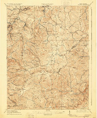
1914 Map of Flattop
USGS Topo · Published 1914About this map
Shady Spring Mountain and a network of high ridges dominate this 1914 survey of southern West Virginia, illustrating a landscape shaped by coal-era expansion and early industry. The industrial footprint is evident in the northwestern corner where the Virginian RR and C & O R R snake through deep valleys to serve settlements like Winding Gulf and Pemberton. A rare industrial marker, the Spangler Factory, sits near Fitzpatrick, while rural life is anchored by an exceptionally high density of neighborhood schools, including the Chestnut Ridge School, Brammer School, and Billy Mills School. The topography is defined by prominent peaks such as Huff Knob and Indian Grave Mtn, with many smaller communities like Ghent and Flattop established along the flatter ridge-top glades rather than the steep-walled river hollows of the Guyan River.
Find a feature on this map
130 named features on this map. Tap any name to fly to it.
Don’t see what you’re looking for? This feature index may not catch every label — zoom into the map to look around manually.
Map Details
Editions of this 1914 Flattop Map
2 editions found
Other maps of this area

1887 · Pocahontas
USGS Topo · 1:125,000

1887 · Hinton
USGS Topo · 1:125,000

1890 · Dublin
USGS Topo · 1:125,000

1891 · Pocahontas
USGS Topo · 1:125,000

1891 · Dublin
USGS Topo · 1:125,000

1891 · Raleigh
USGS Topo · 1:125,000

1892 · Hinton
USGS Topo · 1:125,000

1894 · Pocahontas
USGS Topo · 1:125,000

1895 · Pocahontas
USGS Topo · 1:125,000

1897 · Raleigh
USGS Topo · 1:125,000