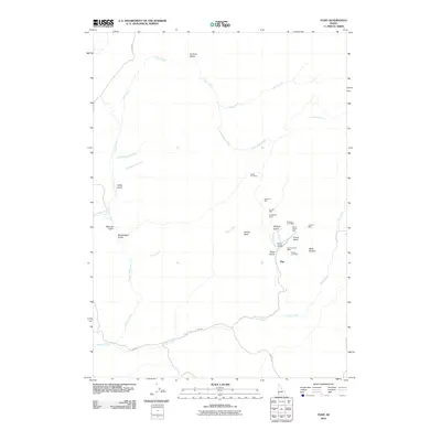
2010 Map of Flint
USGS Topo · Published 2010About this map
Flint anchors this corner of Owyhee County, where a dense concentration of hard-rock mining claims defines the local geography. The landscape is a network of deep ravines and high points, most notably Dewey Peak, which stands above a series of named drainages like Twilight Gulch, Astor Gulch, and Mine Gulch. This area was a hub of mineral exploration, evidenced by the clustered operations along the eastern slopes including the Rising Star Mine, Perseverance Mine, and Silver Queen Mine. Access to these remote sites is provided by the winding Flint Rd and Mining Rd, which follow the contours of the high desert terrain. The drainage systems, including Jordan Creek and Louse Creek, indicate the water sources critical to both the mining industry and the rugged ranching environment of southwest Idaho.
Find a feature on this map
30 named features on this map. Tap any name to fly to it.
Don’t see what you’re looking for? This feature index may not catch every label — zoom into the map to look around manually.
Map Details
Editions of this 2010 Flint Map
This is the sole edition of this map. No revisions or reprints were ever made.
Other maps of this area

1892 · Silver City
USGS Topo · 1:125,000

1894 · Silver City
USGS Topo · 1:125,000

1898 · Silver City
USGS Topo · 1:125,000

1955 · Jordan Valley
USGS Topo · 1:250,000

1955 · Boise
USGS Topo · 1:250,000

1957 · Jordan Valley
USGS Topo · 1:250,000

1958 · Boise
USGS Topo · 1:250,000

1958 · Jordan Valley
USGS Topo · 1:250,000

1962 · Boise
USGS Topo · 1:250,000

1965 · Triangle
USGS Topo · 1:62,500