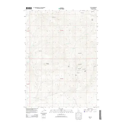
2013 Map of Flint
USGS Topo · Published 2013About this map
Flint occupies a central position within this high-elevation landscape in the Owyhee Mountains, surrounded by a complex network of drainages and peaks. The map reveals a history of resource extraction, indicated by names such as Mining Rd, Mine Gulch, and Black Warrior. The topography is dominated by the western slopes of the Silver City Range, where steep terrain is carved by numerous gulches including Hard Up Gulch, Twilight Gulch, and Astor Gulch. These narrow valleys feed into larger waterways like Jordan Creek and Louise Creek. Settlement patterns appear concentrated near Flint, connected to the wider region by the winding Flint Rd. Notable landmarks such as Dewey Peak and Washington Gulch provide significant navigational points for those tracing the industrial and physical evolution of this corner of Idaho.
Find a feature on this map
31 named features on this map. Tap any name to fly to it.
Don’t see what you’re looking for? This feature index may not catch every label — zoom into the map to look around manually.
Map Details
Editions of this 2013 Flint Map
This is the sole edition of this map. No revisions or reprints were ever made.
Other maps of this area

1892 · Silver City
USGS Topo · 1:125,000

1894 · Silver City
USGS Topo · 1:125,000

1898 · Silver City
USGS Topo · 1:125,000

1955 · Jordan Valley
USGS Topo · 1:250,000

1955 · Boise
USGS Topo · 1:250,000

1957 · Jordan Valley
USGS Topo · 1:250,000

1958 · Boise
USGS Topo · 1:250,000

1958 · Jordan Valley
USGS Topo · 1:250,000

1962 · Boise
USGS Topo · 1:250,000

1965 · Triangle
USGS Topo · 1:62,500