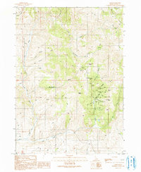
1990 Map of Flint
USGS Topo · Published 1991About this map
Mining operations and prospect sites dominate this portion of the Silver City Range in southwestern Idaho. Concentrated primarily around the settlement of Flint, a network of claims including the Perseverance Mine, Rising Star Mine, and Black Warrior Mine illustrates the intense geological interest in the gulches surrounding Dewey Peak. To the north, the terrain near De Lamar is marked by further industrial activity, including a Mine Dump and Tailings along Jordan Creek.
Find a feature on this map
45 named features on this map. Tap any name to fly to it.
Don’t see what you’re looking for? This feature index may not catch every label — zoom into the map to look around manually.
Map Details
Editions of this 1990 Flint Map
This is the sole edition of this map. No revisions or reprints were ever made.
Other maps of this area

1892 · Silver City
USGS Topo · 1:125,000

1894 · Silver City
USGS Topo · 1:125,000

1898 · Silver City
USGS Topo · 1:125,000

1955 · Jordan Valley
USGS Topo · 1:250,000

1955 · Boise
USGS Topo · 1:250,000

1957 · Jordan Valley
USGS Topo · 1:250,000

1958 · Boise
USGS Topo · 1:250,000

1958 · Jordan Valley
USGS Topo · 1:250,000

1962 · Boise
USGS Topo · 1:250,000

1965 · Triangle
USGS Topo · 1:62,500