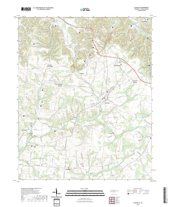
2022 Map of Flintville
USGS Topo · Published 2022About this map
Flintville and its surrounding Lincoln County landscape are defined by the winding course of the Flint River, which anchors a network of smaller drainages including Mulepen Cr and Little Huckleberry Cr. This rural environment is a dense collection of family legacies, with numerous small burial grounds such as the Harris-Jean Cem, Patterson Cem, and Wicks Cem scattered across the uplands. The terrain transitions from the low-lying Sycamore Swamp to several named hollows like Martin Hollow and Cowley Hollow. Small communities like Vanntown and Corder Crossroads serve as local hubs, connected by a network of rural roads that often follow the natural contours of the land. Landmarks like Vinsons Mill Springs and Steelman Lake provide specific points of interest for those tracing the hydrography and early industrial or agricultural sites of the region.
Find a feature on this map
146 named features on this map. Tap any name to fly to it.
Don’t see what you’re looking for? This feature index may not catch every label — zoom into the map to look around manually.
Map Details
Editions of this 2022 Flintville Map
This is the sole edition of this map. No revisions or reprints were ever made.
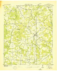
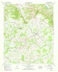
Historical Maps of Flintville Through Time
3 maps found