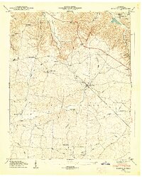
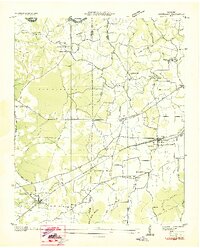
1947 Map of Flintville
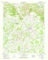
USGS Topo · Published 1973About this map
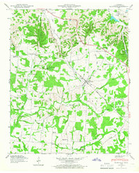
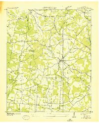
The Flint River and its numerous tributaries, including Mulepen Creek and Big Huckleberry Creek, define the topography of this southern Lincoln County landscape. Centered on the settlement of Flintville, the map reveals a rural economy deeply tied to the Louisville and Nashville railroad line, which cuts through the terrain near Milners Switch. The upland prominence of Pea Ridge dominates the central portion of the sheet, surrounded by a network of family-named cemeteries such as Wicks Cem and Morgan Cem, and small community centers like Brighton and Vanntown. An interesting industrial and conservation landmark, the State Fish Hatchery, is located in the northeast near Smithland, utilizing the local water sources that flow from the hollows. The prevalence of small country churches and the Vann Sch suggests a late 1940s landscape of established, close-knit rural districts before the modernization of the late 20th century.
Find a feature on this map
57 named features on this map. Tap any name to fly to it.
Don’t see what you’re looking for? This feature index may not catch every label — zoom into the map to look around manually.
Map Details
Editions of this 1947 Flintville Map
3 editions found
Other maps of this area

1888 · Scottsboro
USGS Topo · 1:125,000

1888 · Huntsville
USGS Topo · 1:125,000

1892 · Huntsville
USGS Topo · 1:125,000

1892 · Scottsboro
USGS Topo · 1:125,000

1936 · King Cove
USGS Topo · 1:24,000
1936 · Flintville
USGS Topo · 1:24,000

1936 · Fisk
USGS Topo · 1:24,000

1936 · Lincoln
USGS Topo · 1:24,000
1936 · Huntland
USGS Topo · 1:24,000
1936 · New Market
USGS Topo · 1:24,000