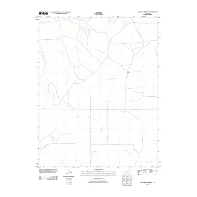
2010 Map of Floating W Ranch
USGS Topo · Published 2010About this map
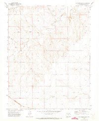
Floating W Ranch serves as the primary named settlement in this high plains landscape of southeastern Colorado, situated near the headwaters of West Clay Creek. The area is defined by an extensive drainage system that feeds into the Arkansas River basin, including the meandering paths of Mud Creek, Little Angry Creek, and Maverick Creek. These watercourses carve through the terrain, dictating the layout of the rural road network, such as County Road C and County Road 32. The map illustrates a classic ranching environment where large parcels of land are segmented by section-line roads, a pattern common in Baca County. To the south, the topography descends toward the riparian corridor of Two Butte Creek, providing a detailed look at the drainage patterns and land use in this specific corner of the Colorado prairie during the early twenty-first century.
Find a feature on this map
19 named features on this map. Tap any name to fly to it.
Don’t see what you’re looking for? This feature index may not catch every label — zoom into the map to look around manually.
Map Details
Editions of this 2010 Floating W Ranch Map
This is the sole edition of this map. No revisions or reprints were ever made.
Other maps of this area

1892 · Two Butte
USGS Topo · 1:125,000

1893 · Two Butte
USGS Topo · 1:125,000

1955 · La Junta
USGS Topo · 1:250,000

1958 · La Junta
USGS Topo · 1:250,000

1967 · Hand Springs
USGS Topo · 1:24,000

1968 · La Junta
USGS Topo · 1:250,000
1968 · Dripping Spring
USGS Topo · 1:24,000
1968 · Cat Creek
USGS Topo · 1:24,000
1971 · Big Rock Grange
USGS Topo · 1:24,000
1971 · Mc Endree Ranch
USGS Topo · 1:24,000