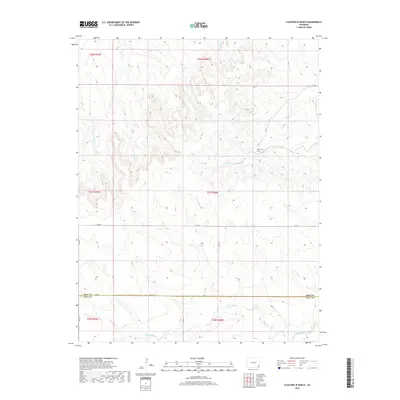
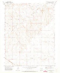
2019 Map of Floating W Ranch
USGS Topo · Published 2019About this map
The Floating W Ranch sits near the intersection of several seasonal watercourses in this high plains landscape on the border of Bent and Baca counties. The terrain is defined by a dense network of drainage systems, including the branching paths of West Clay Creek and W Clay Cr, which carve through the arid plateaus. In the southern portion of the sheet, the landscape transitions toward Maverick Cr and the larger Two Butte Cr corridor. A regular grid of county roads, such as Co RD A and Co RD G, provides the primary infrastructure for this ranching country, reflecting the large-scale land divisions common in eastern Colorado. The map captures the quiet character of the region's cattle-ranching heritage, where life is dictated by the availability of water at features like Little Angry Cr and Mud Cr.
Find a feature on this map
25 named features on this map. Tap any name to fly to it.
Don’t see what you’re looking for? This feature index may not catch every label — zoom into the map to look around manually.
Map Details
Editions of this 2019 Floating W Ranch Map
This is the sole edition of this map. No revisions or reprints were ever made.
Other maps of this area

1892 · Two Butte
USGS Topo · 1:125,000

1893 · Two Butte
USGS Topo · 1:125,000

1955 · La Junta
USGS Topo · 1:250,000

1958 · La Junta
USGS Topo · 1:250,000

1967 · Hand Springs
USGS Topo · 1:24,000

1968 · La Junta
USGS Topo · 1:250,000
1968 · Dripping Spring
USGS Topo · 1:24,000
1968 · Cat Creek
USGS Topo · 1:24,000
1971 · Big Rock Grange
USGS Topo · 1:24,000
1971 · Mc Endree Ranch
USGS Topo · 1:24,000