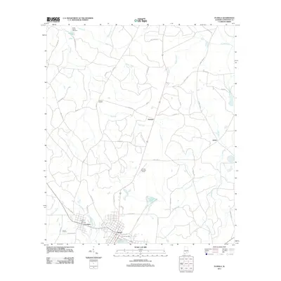
2011 Map of Florala
USGS Topo · Published 2011About this map
Florala and neighboring Lockhart anchor the southern edge of this Covington County landscape, situated where the Alabama border meets Florida. The topography is defined by the significant waters of Lake Jackson and a network of creeks, including the winding Moccasin Branch and Corner Creek. The map documents a rural infrastructure where smaller named settlements like Stedman, McRae, and Johnsons Quarters are connected by a web of local routes such as Shoe String Rd and Tung Oil Rd.
Find a feature on this map
52 named features on this map. Tap any name to fly to it.
Don’t see what you’re looking for? This feature index may not catch every label — zoom into the map to look around manually.
Map Details
Editions of this 2011 Florala Map
This is the sole edition of this map. No revisions or reprints were ever made.
Other maps of this area

1949 · Glendale
USGS Topo · 1:62,500

1949 · Laurel Hill
USGS Topo · 1:62,500

1950 · Laurel Hill
USGS Topo · 1:62,500

1951 · Glendale
USGS Topo · 1:62,500

1953 · Andalusia
USGS Topo · 1:250,000

1957 · Andalusia
USGS Topo · 1:250,000

1957 · Pensacola
USGS Topo · 1:250,000

1959 · Pensacola
USGS Topo · 1:250,000

1960 · Pensacola
USGS Topo · 1:250,000
1969 · Hacoda
USGS Topo · 1:24,000