
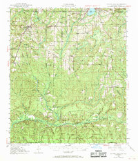
1949 Map of Laurel Hill
USGS Topo · Published 1961About this map
Laurel Hill serves as a primary hub in this late 1940s landscape, positioned near the intersection of local routes and the Louisville and Nashville Railroad. The region is defined by a complex network of wetlands and creek systems, including Watson Bay, Pennywinkle Bay, and Tyner Bay, which feed southward toward the Shoal River. These natural features dictated the early settlement patterns of Okaloosa and Walton counties, where rural life centered on small congregations and family grounds.
Find a feature on this map
75 named features on this map. Tap any name to fly to it.
Don’t see what you’re looking for? This feature index may not catch every label — zoom into the map to look around manually.
Map Details
Editions of this 1949 Laurel Hill Map
2 editions found
Other maps of this area

1934 · Holt
USGS Topo · 1:48,000

1934 · Niceville
USGS Topo · 1:48,000

1935 · De Funiak Springs
USGS Topo · 1:48,000

1936 · Niceville
USGS Topo · 1:62,500

1937 · Holt
USGS Topo · 1:62,500

1938 · De Funiak Springs
USGS Topo · 1:62,500

1949 · Glendale
USGS Topo · 1:62,500

1949 · Crestview
USGS Topo · 1:62,500

1950 · Laurel Hill
USGS Topo · 1:62,500

1951 · Glendale
USGS Topo · 1:62,500