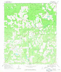
1969 Map of Hacoda
USGS Topo · Published 1971About this map
Geneva State Forest dominates the northeastern landscape of this South Alabama quadrangle, bordering the line between Covington and Geneva counties. The map documents a predominantly rural and forested region in the late 1960s, punctuated by small community centers like Hacoda, Roberts, and Howells. The transportation history of the area is visible through the Old Railroad Grade that cuts diagonally across the terrain, indicating a shift from rail-based industry to the road networks of the mid-20th century.
Find a feature on this map
28 named features on this map. Tap any name to fly to it.
Don’t see what you’re looking for? This feature index may not catch every label — zoom into the map to look around manually.
Map Details
Editions of this 1969 Hacoda Map
This is the sole edition of this map. No revisions or reprints were ever made.
Other maps of this area

1949 · Glendale
USGS Topo · 1:62,500

1949 · Laurel Hill
USGS Topo · 1:62,500

1950 · Laurel Hill
USGS Topo · 1:62,500

1951 · Glendale
USGS Topo · 1:62,500

1953 · Andalusia
USGS Topo · 1:250,000

1957 · Andalusia
USGS Topo · 1:250,000

1957 · Pensacola
USGS Topo · 1:250,000

1959 · Pensacola
USGS Topo · 1:250,000

1960 · Pensacola
USGS Topo · 1:250,000
1968 · Samson
USGS Topo · 1:24,000