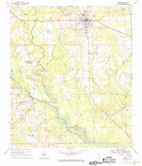
1968 Map of Samson
USGS Topo · Published 1970About this map
The Louisville and Nashville railroad anchors the local economy in this late 1960s survey of southern Alabama, passing through the established street grid of Samson. The town serves as a regional hub, featuring the Samson Municipal Airport, a Community Center, and educational sites like Lewis High Sch. Outside the central town, the landscape is defined by the winding course of the Pea River, which is fed by numerous tributaries including Flat Creek and Gin Creek.
Find a feature on this map
43 named features on this map. Tap any name to fly to it.
Don’t see what you’re looking for? This feature index may not catch every label — zoom into the map to look around manually.
Map Details
Editions of this 1968 Samson Map
2 editions found
Other maps of this area

1942 · Enterprise
USGS Topo · 1:125,000

1949 · Glendale
USGS Topo · 1:62,500

1949 · Hobbs Crossroads
USGS Topo · 1:24,000

1950 · Hobbs Cross Roads
USGS Topo · 1:24,000

1951 · Glendale
USGS Topo · 1:62,500

1953 · Andalusia
USGS Topo · 1:250,000

1953 · Dothan
USGS Topo · 1:250,000

1954 · Dothan
USGS Topo · 1:250,000

1954 · Tallahassee
USGS Topo · 1:250,000

1955 · Dothan
USGS Topo · 1:250,000