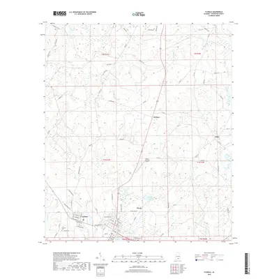
2018 Map of Florala
USGS Topo · Published 2018About this map
Florala and Lockhart anchor the southern landscape of Covington County near the Florida state line, separated by the small drainage of Moccasin Br. The municipal layout of Florala is defined by a traditional grid that extends toward the shores of Lake Jackson, while the neighboring community of Lockhart features the Lockhart Cem and a distinct network of local streets including Seminole, Cherokee, and Chickasaw. The transition from town to timberland is marked by the Florala Municipal Airport and a dense web of secondary roads such as Tram Rd and Tram Loop, which reflect the region's historical reliance on forestry and transport. To the north, the terrain becomes more rural, punctuated by small settlements like Stedman and McRae, and natural water features including Thomas Pond and Lawrence Pond.
Find a feature on this map
89 named features on this map. Tap any name to fly to it.
Don’t see what you’re looking for? This feature index may not catch every label — zoom into the map to look around manually.
Map Details
Editions of this 2018 Florala Map
This is the sole edition of this map. No revisions or reprints were ever made.
Other maps of this area

1949 · Glendale
USGS Topo · 1:62,500

1949 · Laurel Hill
USGS Topo · 1:62,500

1950 · Laurel Hill
USGS Topo · 1:62,500

1951 · Glendale
USGS Topo · 1:62,500

1953 · Andalusia
USGS Topo · 1:250,000

1957 · Andalusia
USGS Topo · 1:250,000

1957 · Pensacola
USGS Topo · 1:250,000

1959 · Pensacola
USGS Topo · 1:250,000

1960 · Pensacola
USGS Topo · 1:250,000
1969 · Hacoda
USGS Topo · 1:24,000