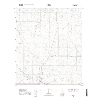
2020 Map of Florala
USGS Topo · Published 2020About this map
Florala and Lockhart anchor this Covington County landscape, where the town grid of Florala meets the northern shores of Lake Jackson. The area is defined by a dense network of local roads and watercourses, including the westward-flowing Pond Cr and Fleming Cr, which drained the pine lands into the Choctawhatchee basin. Local history is etched into the landscape at the Lockhart Cem and via the naming of nearby rural crossroads like McRae and Stedman.
Find a feature on this map
85 named features on this map. Tap any name to fly to it.
Don’t see what you’re looking for? This feature index may not catch every label — zoom into the map to look around manually.
Map Details
Editions of this 2020 Florala Map
This is the sole edition of this map. No revisions or reprints were ever made.
Other maps of this area

1949 · Glendale
USGS Topo · 1:62,500

1949 · Laurel Hill
USGS Topo · 1:62,500

1950 · Laurel Hill
USGS Topo · 1:62,500

1951 · Glendale
USGS Topo · 1:62,500

1953 · Andalusia
USGS Topo · 1:250,000

1957 · Andalusia
USGS Topo · 1:250,000

1957 · Pensacola
USGS Topo · 1:250,000

1959 · Pensacola
USGS Topo · 1:250,000

1960 · Pensacola
USGS Topo · 1:250,000
1969 · Hacoda
USGS Topo · 1:24,000