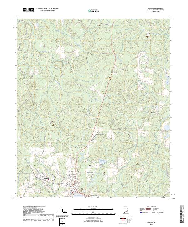
2024 Map of Florala
USGS Topo · Published 2024About this map
Florala and its neighbor Lockhart anchor this landscape along the Alabama-Florida border, where local life has long revolved around the waters of Lake Jackson. The town plans reveal a structured grid of residential streets like Locklair Ave and Seminole St, transitioning quickly into the timber and agricultural lands that define Covington County. To the north, the geography is marked by the drainages of Clear Creek, Beaver Creek, and Panther Creek, which cut through a network of rural routes such as Tram Rd and Muscadine RD. Smaller communities like Stedman and McRae sit at rural crossroads, while the Florala Municipal Airport and Lockhart Cem provide specific points of interest for local historians. This contemporary survey captures a region defined by its hydrology, from the broad expanse of the lake to the smaller Thomas Pond and Lawrence Pond in the upland pine woods.
Find a feature on this map
91 named features on this map. Tap any name to fly to it.
Don’t see what you’re looking for? This feature index may not catch every label — zoom into the map to look around manually.
Map Details
Editions of this 2024 Florala Map
This is the sole edition of this map. No revisions or reprints were ever made.
Other maps of this area

1949 · Glendale
USGS Topo · 1:62,500

1949 · Laurel Hill
USGS Topo · 1:62,500

1950 · Laurel Hill
USGS Topo · 1:62,500

1951 · Glendale
USGS Topo · 1:62,500

1953 · Andalusia
USGS Topo · 1:250,000

1957 · Andalusia
USGS Topo · 1:250,000

1957 · Pensacola
USGS Topo · 1:250,000

1959 · Pensacola
USGS Topo · 1:250,000

1960 · Pensacola
USGS Topo · 1:250,000
1969 · Hacoda
USGS Topo · 1:24,000