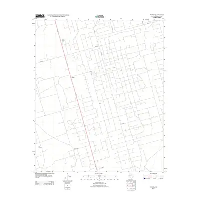
2012 Map of Florey
USGS Topo · Published 2012About this map
Florey sits at the center of this 2012 survey, defining a pocket of settlement within a landscape heavily shaped by the West Texas petroleum industry. The region is characterized by an extensive network of service roads and industrial infrastructure, most notably the Means Oil Field and the East Shafter Lake Oil Field. These fields represent the primary economic engine of Andrews County, where the regular grid of local routes like Means Rd and Fisher Rd provides access to numerous well sites. Interspersed among these modern industrial features are traditional ranching landmarks, such as Bull Pasture Windmill and North Evans Windmill, which speak to the area's dual identity as both oil country and cattle land. The map offers a precise look at the intersection of energy extraction and rural habitation in the early 21st century.
Find a feature on this map
21 named features on this map. Tap any name to fly to it.
Don’t see what you’re looking for? This feature index may not catch every label — zoom into the map to look around manually.
Map Details
Editions of this 2012 Florey Map
This is the sole edition of this map. No revisions or reprints were ever made.
Other maps of this area

1954 · Hobbs
USGS Topo · 1:250,000

1958 · Hobbs
USGS Topo · 1:250,000

1963 · Andrews
USGS Topo · 1:24,000

1969 · Seminole SW
USGS Topo · 1:24,000

1970 · Cedar Point Ranch
USGS Topo · 1:24,000

1970 · Seminole SE
USGS Topo · 1:24,000

1971 · Five Wells Ranch NW
USGS Topo · 1:24,000

1971 · Florey
USGS Topo · 1:24,000
1971 · Five Wells Ranch SW
USGS Topo · 1:24,000

1971 · Shafter Lake
USGS Topo · 1:24,000