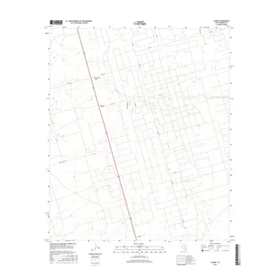
2016 Map of Florey
USGS Topo · Published 2016About this map
Florey stands as the primary settlement in this section of Andrews County, situated where several local routes converge in the West Texas plains. The landscape is defined by the shallow, winding course of Monument Draw, a significant drainage feature that cuts across the northern half of the territory. A dense grid of numbered section roads and named thoroughfares like Fisher Rd and Means Rd reveals the organized land divisions typical of the region's ranching and energy-producing history. The presence of the Frankel City Hwy connecting through the western portion reflects the area's mid-century development and its ties to neighboring industrial hubs. This survey provides a clear view of the intersection between natural draws and the rigid geometric infrastructure of the Permian Basin.
Find a feature on this map
18 named features on this map. Tap any name to fly to it.
Don’t see what you’re looking for? This feature index may not catch every label — zoom into the map to look around manually.
Map Details
Editions of this 2016 Florey Map
This is the sole edition of this map. No revisions or reprints were ever made.
Other maps of this area

1954 · Hobbs
USGS Topo · 1:250,000

1958 · Hobbs
USGS Topo · 1:250,000

1963 · Andrews
USGS Topo · 1:24,000

1969 · Seminole SW
USGS Topo · 1:24,000

1970 · Cedar Point Ranch
USGS Topo · 1:24,000

1970 · Seminole SE
USGS Topo · 1:24,000

1971 · Five Wells Ranch NW
USGS Topo · 1:24,000

1971 · Florey
USGS Topo · 1:24,000
1971 · Five Wells Ranch SW
USGS Topo · 1:24,000

1971 · Shafter Lake
USGS Topo · 1:24,000