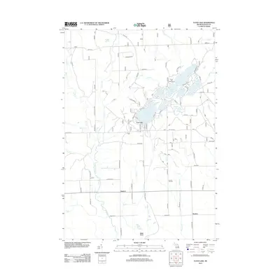
2012 Map of Floyd Lake
USGS Topo · Published 2012About this map
The Sand Lake area of Iosco County is defined by a dense concentration of glacial lakes and small rural settlements during the early 21st century. The landscape is dotted with named water bodies such as Vaughn Lake, Indian Lake, and Bass Lake, which are connected by a network of local roads and recreational sites like the Round Lake Campground. To the south, the terrain transitions into the drainage basin of the E Br Au Gres River, where the smaller communities of Hemlock, White Rock, and Meadow are situated. Family history and local heritage are anchored by the Pioneer Cem near the central lakes and Pine Top Rest Cem further south. The map reflects a region where the proximity to numerous lakes and creeks like Manary Cr and Saddler Cr has shaped the local residential and seasonal settlement patterns.
Find a feature on this map
76 named features on this map. Tap any name to fly to it.
Don’t see what you’re looking for? This feature index may not catch every label — zoom into the map to look around manually.
Map Details
Editions of this 2012 Floyd Lake Map
This is the sole edition of this map. No revisions or reprints were ever made.
Other maps of this area

1954 · Tawas City
USGS Topo · 1:250,000

1958 · Tawas City
USGS Topo · 1:250,000

1959 · Tawas City
USGS Topo · 1:62,500

1966 · Alabaster
USGS Topo · 1:24,000

1966 · National City
USGS Topo · 1:24,000

1968 · Hale
USGS Topo · 1:24,000

1968 · Whittemore
USGS Topo · 1:24,000

1968 · Hale SE
USGS Topo · 1:24,000

1984 · Tawas City
USGS Topo · 1:100,000
1989 · Sid Town
USGS Topo · 1:24,000