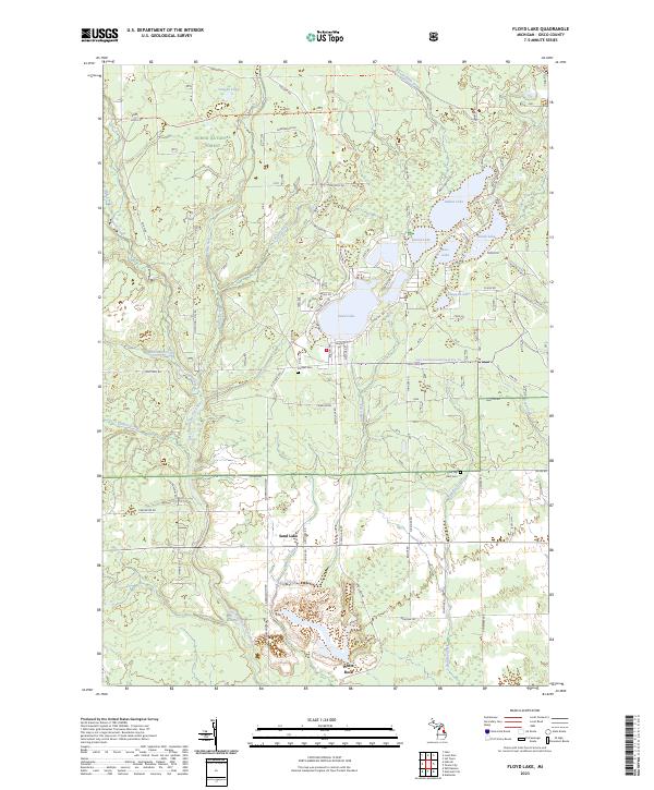
2023 Map of Floyd Lake
USGS Topo · Published 2023About this map
The Huron National Forest dominates the western portion of this Iosco County landscape, where the East Branch Au Gres River and its tributaries carve through the forested terrain. The settlement of Sand Lake serves as a central point for a dense network of lakes, including Indian Lake, Round Lake, and Vaughn Lake. This area is characterized by its high concentration of glacial lakes and small creeks like Saddler Creek and Dead Creek, which define the local drainage patterns. Genealogists may find interest in the documented burial sites, such as Pioneer Cem and Pine Top Rest Cem, while local history is reflected in named landmarks like White Rock and the Iosco Smt Monument Road Dnr Trl. The map illustrates a community established around these water bodies, with seasonal and permanent roads such as Old State Rd and Indian Lake Rd providing access to the various shorelines and forest interiors.
Find a feature on this map
82 named features on this map. Tap any name to fly to it.
Don’t see what you’re looking for? This feature index may not catch every label — zoom into the map to look around manually.
Map Details
Editions of this 2023 Floyd Lake Map
This is the sole edition of this map. No revisions or reprints were ever made.
Other maps of this area

1954 · Tawas City
USGS Topo · 1:250,000

1958 · Tawas City
USGS Topo · 1:250,000

1959 · Tawas City
USGS Topo · 1:62,500

1966 · Alabaster
USGS Topo · 1:24,000

1966 · National City
USGS Topo · 1:24,000

1968 · Hale
USGS Topo · 1:24,000

1968 · Whittemore
USGS Topo · 1:24,000

1968 · Hale SE
USGS Topo · 1:24,000

1984 · Tawas City
USGS Topo · 1:100,000
1989 · Sid Town
USGS Topo · 1:24,000