
1956 Map of Flynn
USGS Topo · Published 1958About this map
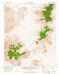
The Union Pacific line cuts through the arid northern landscape of the Mojave, connecting the siding at Flynn to the broader rail network. This mid-century survey illustrates a region defined by water scarcity and mineral extraction, where life congregates around remote outposts like Pine Tree Ranch and the seasonal refuge of Dorners Camp. The high peaks of the Providence Mountains dominate the eastern view, home to Mitchell Caverns State Park and the curious Winding Stair Cave. Extensive mining operations are documented throughout the slopes, including the Bonanza King Mine, Rex Mine, and Vulcan Mine. To the west, the landscape shifts toward the shifting sands of the Devils Playground and the Kelso Dunes, while a network of washes like Winston Wash and Kelso Wash trace the paths of infrequent desert rains toward the Granite Mountains.
Find a feature on this map
54 named features on this map. Tap any name to fly to it.
Don’t see what you’re looking for? This feature index may not catch every label — zoom into the map to look around manually.
Map Details
Editions of this 1956 Flynn Map
3 editions found
Other maps of this area

1910 · Ivanpah
USGS Topo · 1:250,000

1912 · Ivanpah
USGS Topo · 1:250,000

1942 · Ivanpah
USGS Topo · 1:250,000

1942 · Amboy
USGS Topo · 1:250,000

1943 · Amboy
USGS Topo · 1:250,000

1943 · Danby
USGS Topo · 1:62,500

1947 · Kingman
USGS Topo · 1:250,000

1948 · Kingman
USGS Topo · 1:250,000

1954 · Needles
USGS Topo · 1:250,000

1954 · Kingman
USGS Topo · 1:250,000