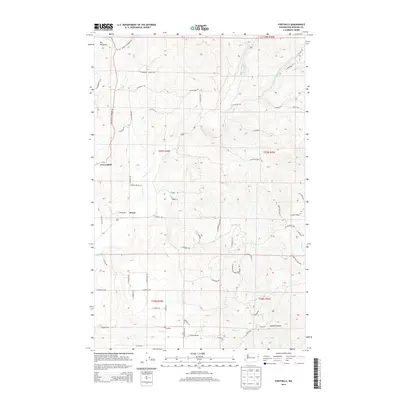
2014 Map of Foothills
USGS Topo · Published 2014About this map
Peone and Foothills sit at the southern edge of this landscape, where the flatlands of the Peone Cr drainage meet the rising foothills of the Spokane region. To the northwest, the prominent community of Green Bluff overlooks a series of rolling agricultural and timbered slopes. The terrain is deeply carved by watercourses like Deadman Cr and Newman Cr, which define the local topography and historical travel routes. In the northern reaches, Big Meadows provides a distinct break in the elevation near the S Fork Little Deep Cr. The network of local roads, such as N Day Mount Spokane Rd and N Forker Rd, illustrates the modern rural development patterns that have evolved from early settlement paths, while features like Canfield Gulch highlight the more remote, natural drainage systems typical of the Inland Northwest.
Find a feature on this map
64 named features on this map. Tap any name to fly to it.
Don’t see what you’re looking for? This feature index may not catch every label — zoom into the map to look around manually.
Map Details
Editions of this 2014 Foothills Map
This is the sole edition of this map. No revisions or reprints were ever made.
Other maps of this area

1901 · Spokane
USGS Topo · 1:125,000

1943 · Mt Spokane
USGS Topo · 1:62,500

1949 · Deer Park
USGS Topo · 1:62,500

1949 · Greenacres
USGS Topo · 1:62,500

1950 · Spokane NE
USGS Topo · 1:24,000

1950 · Mt Spokane
USGS Topo · 1:62,500

1950 · Spokane
USGS Topo · 1:62,500

1951 · Deer Park
USGS Topo · 1:62,500

1951 · Greenacres
USGS Topo · 1:62,500

1955 · Spokane
USGS Topo · 1:250,000