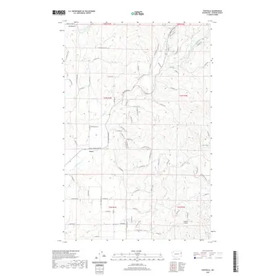
2020 Map of Foothills
USGS Topo · Published 2020About this map
Peone and Foothills anchor this rural landscape in northern Spokane County, where the topography transitions into the high country near Mount Spokane. The area is defined by a complex drainage system, primarily fed by Deadman Cr and its southern fork, alongside Peone Cr and the waters of S Fork Little Deep Cr. This 2020 survey reveals a web of residential and access roads, such as N Mt Spokane Park Dr and N Mt Carlton Rd, which navigate the rising elevations and gulches. The terrain is marked by significant open spaces like Big Meadows to the north and the steep descent of Canfield Gulch in the southeast. This contemporary record captures the modern footprint of these long-established agricultural and foothill communities, showing how roads have evolved to follow the natural contours of the drainage basins.
Find a feature on this map
79 named features on this map. Tap any name to fly to it.
Don’t see what you’re looking for? This feature index may not catch every label — zoom into the map to look around manually.
Map Details
Editions of this 2020 Foothills Map
This is the sole edition of this map. No revisions or reprints were ever made.
Other maps of this area

1901 · Spokane
USGS Topo · 1:125,000

1943 · Mt Spokane
USGS Topo · 1:62,500

1949 · Deer Park
USGS Topo · 1:62,500

1949 · Greenacres
USGS Topo · 1:62,500

1950 · Spokane NE
USGS Topo · 1:24,000

1950 · Mt Spokane
USGS Topo · 1:62,500

1950 · Spokane
USGS Topo · 1:62,500

1951 · Deer Park
USGS Topo · 1:62,500

1951 · Greenacres
USGS Topo · 1:62,500

1955 · Spokane
USGS Topo · 1:250,000