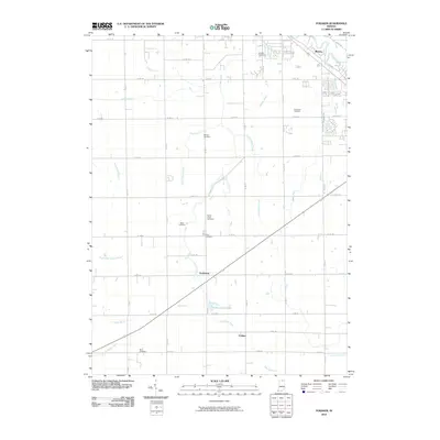
2010 Map of Foraker
USGS Topo · Published 2010About this map
Foraker and Midway anchor this agricultural landscape in northern Indiana, where the terrain is defined by an intricate network of drainage ditches that have historically supported the region's farming economy. The map reveals a dense concentration of local heritage sites, particularly numerous family and community burial grounds such as Burkett Cemetery, Stutsman Cemetery, and Bull Cemetery. These sites, along with the settlement of Southwest, suggest a deeply rooted rural community structure. The Elkhart River clips the northeast corner of the quadrangle near Midway, while Yellow Creek and its many tributaries, including Little Yellow Creek and Owl Creek, meander across the center. The presence of named water features like Fetters Martin Ditch and Davidhizer Ditch highlights the local effort to manage the water table for cultivation throughout the late twentieth century.
Find a feature on this map
51 named features on this map. Tap any name to fly to it.
Don’t see what you’re looking for? This feature index may not catch every label — zoom into the map to look around manually.
Map Details
Editions of this 2010 Foraker Map
This is the sole edition of this map. No revisions or reprints were ever made.
Other maps of this area

1951 · Milford
USGS Topo · 1:24,000

1953 · Fort Wayne
USGS Topo · 1:250,000

1953 · Chicago
USGS Topo · 1:250,000

1956 · Fort Wayne
USGS Topo · 1:250,000

1957 · Chicago
USGS Topo · 1:250,000

1958 · Nappanee West
USGS Topo · 1:24,000

1958 · Osceola
USGS Topo · 1:24,000

1958 · Nappanee East
USGS Topo · 1:24,000

1959 · Goshen
USGS Topo · 1:24,000

1960 · Foraker
USGS Topo · 1:24,000