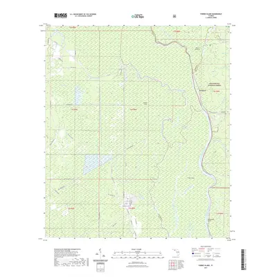
2021 Map of Forbes Island
USGS Topo · Published 2021About this map
The Apalachicola River winds through a dense landscape of swamplands and riverine islands in this modern survey of the Apalachicola National Forest. This section of the Panhandle is defined by its complex hydrology, where the main river channel is joined by a network of smaller streams such as Brushy Creek, Harrison Creek, and Smokehouse Creek. Landforms like Forbes Island and Bloody Bluff Island are shaped by these shifting currents, while the settlement of Brickyard serves as a key human landmark along the river's eastern bank. Local history and genealogy interest is anchored by the Brown and Smith Cem and named trails like the Apalachicola River Blueway Trl and Wiregrass Trl. The map illustrates how primitive roads like Old Bay City Rd and Doc Whitefield Rd provide access to the interior wetlands, connecting remote locations such as Downes Island and Robinson Bay.
Find a feature on this map
54 named features on this map. Tap any name to fly to it.
Don’t see what you’re looking for? This feature index may not catch every label — zoom into the map to look around manually.
Map Details
Editions of this 2021 Forbes Island Map
This is the sole edition of this map. No revisions or reprints were ever made.
Other maps of this area

1943 · Jackson River
USGS Topo · 1:24,000

1944 · White City
USGS Topo · 1:24,000

1944 · Forbes Island
USGS Topo · 1:24,000

1945 · Forbes Island
USGS Topo · 1:31,680

1945 · Lake Wimico
USGS Topo · 1:31,680

1945 · Kennedy Creek
USGS Topo · 1:31,680

1945 · White City
USGS Topo · 1:31,680

1945 · Beverly
USGS Topo · 1:31,680

1945 · Wewahitchka
USGS Topo · 1:31,680

1945 · Jackson River
USGS Topo · 1:31,680