
1945 Map of White City
USGS Topo · Published 1945About this map
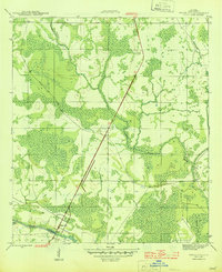
White City stands as a small hub of activity in this 1940s landscape, situated at the intersection of a major highway and the Intracoastal Waterway. This area in Gulf County reflects a period when the regional economy was deeply tied to the surrounding wetlands and timber industry, evidenced by the presence of a Logging RR that cuts through the dense eastern swamps toward Cypress Creek. To the west, the Gulf Co Canal branches off from the waterway, highlighting the importance of navigational engineering in these coastal lowlands. Elevated above the marshy terrain, the St Joe Fire Tower provides a fixed landmark north of the settlement, serving as a critical point for forest management and monitoring during the mid-twentieth century.
Find a feature on this map
7 named features on this map. Tap any name to fly to it.
Don’t see what you’re looking for? This feature index may not catch every label — zoom into the map to look around manually.
Map Details
Editions of this 1945 White City Map
3 editions found
Other maps of this area

1943 · Port St. Joe
USGS Topo · 1:31,680

1943 · Overstreet
USGS Topo · 1:31,680

1943 · Jackson River
USGS Topo · 1:24,000

1944 · White City
USGS Topo · 1:24,000

1944 · Forbes Island
USGS Topo · 1:24,000

1945 · Forbes Island
USGS Topo · 1:31,680

1945 · Lake Wimico
USGS Topo · 1:31,680

1945 · Kennedy Creek
USGS Topo · 1:31,680

1945 · Wewahitchka
USGS Topo · 1:31,680

1945 · Wetappo Creek
USGS Topo · 1:31,680