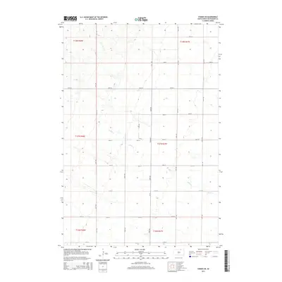
2015 Map of Forbes SW
USGS Topo · Published 2015About this map
Willow Cr meanders through the heart of this rural McPherson County landscape, providing the primary drainage for a section of the Great Plains characterized by its steady, methodical township and range grid. This 2015 survey reveals the persistence of the section-line road system, where corridors such as 361st Ave and 364th Ave serve as the primary conduits for local transport. The landscape is defined by its agricultural layout, marked by a series of numbered east-west thoroughfares from 105th St down to 113th St. While human settlement is sparse, the presence of Cr-19 and Ash Pl indicates the subtle infrastructure supporting the ranching and farming operations in this corner of South Dakota. The topography is etched with the drainage patterns of the creek and its intermittent tributaries, showing how the natural hydrology interacts with the rigid geometric boundaries of the public land survey system.
Find a feature on this map
23 named features on this map. Tap any name to fly to it.
Don’t see what you’re looking for? This feature index may not catch every label — zoom into the map to look around manually.
Map Details
Editions of this 2015 Forbes SW Map
This is the sole edition of this map. No revisions or reprints were ever made.
Other maps of this area

1899 · Ellendale
USGS Topo · 1:125,000

1954 · Aberdeen
USGS Topo · 1:250,000

1956 · Aberdeen
USGS Topo · 1:250,000

1968 · Long Lake SE
USGS Topo · 1:24,000

1968 · Forbes
USGS Topo · 1:24,000

1968 · Long Lake NE
USGS Topo · 1:24,000

1968 · Forbes SE
USGS Topo · 1:24,000
1968 · Forbes NW
USGS Topo · 1:24,000

1968 · Forbes SW
USGS Topo · 1:24,000

1970 · Leola
USGS Topo · 1:24,000