
1968 Map of Forbes
USGS Topo · Published 1970About this map
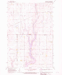
Forbes sits at the center of this 1968 land study, positioned precisely on the border between Dickey Co and McPherson Co. The settlement's infrastructure at this time is defined by the Great Northern railroad line, which skirts the northern edge of the town near the Sewage Disposal Pond and the local Forbes Cem. The landscape transitions from the North Dakota plains into South Dakota, marked by large territorial divisions including Lorraine, Wachter, and Weber. These township-level designations reflect the late-1960s agricultural organization of the region. The map captures a moment of established rail-dependent commerce before the widespread shift in mid-century rural logistics, showing the primary transport corridors and local landmarks vital to the community's identity.
Find a feature on this map
10 named features on this map. Tap any name to fly to it.
Don’t see what you’re looking for? This feature index may not catch every label — zoom into the map to look around manually.
Map Details
Editions of this 1968 Forbes Map
This is the sole edition of this map. No revisions or reprints were ever made.
Other maps of this area

1894 · Monango
USGS Topo · 1:62,500

1894 · Ellendale
USGS Topo · 1:62,500

1896 · Edgeley
USGS Topo · 1:125,000

1899 · Ellendale
USGS Topo · 1:125,000

1925 · Edgeley
USGS Topo · 1:125,000

1953 · Jamestown
USGS Topo · 1:250,000

1954 · Aberdeen
USGS Topo · 1:250,000

1956 · Aberdeen
USGS Topo · 1:250,000

1956 · Jamestown
USGS Topo · 1:250,000
1968 · Frederick NW
USGS Topo · 1:24,000