
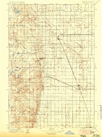
1896 Map of Edgeley
USGS Topo · Published 1896About this map
Three distinct rail lines converge on the central plains of North Dakota in this late nineteenth-century study, marking the rapid expansion of transport infrastructure across LaMoure and Dickey counties. The Northern Pacific Railroad Fargo and Southwestern Br. enters from the east, while the Chicago Milwaukee and St. Paul R. R. cuts a long diagonal path through the settlement of Edgeley. Further south, the Minneapolis St. Paul and Sault Ste. Marie R. R. connects smaller outposts like Merricourt and Monango.
Find a feature on this map
37 named features on this map. Tap any name to fly to it.
Don’t see what you’re looking for? This feature index may not catch every label — zoom into the map to look around manually.
Map Details
Editions of this 1896 Edgeley Map
2 editions found
Other maps of this area

1894 · Monango
USGS Topo · 1:62,500

1894 · La Moure
USGS Topo · 1:62,500

1894 · Ellendale
USGS Topo · 1:62,500

1894 · Savo
USGS Topo · 1:62,500

1894 · Fullerton
USGS Topo · 1:62,500

1895 · Lamoure
USGS Topo · 1:125,000

1896 · Columbia
USGS Topo · 1:125,000

1896 · Jamestown
USGS Topo · 1:125,000

1897 · Eckelson
USGS Topo · 1:125,000

1899 · Ellendale
USGS Topo · 1:125,000