
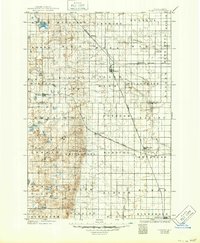
1925 Map of Edgeley
USGS Topo · Published 1925About this map
Whitestone Battlefield Park anchors the south-central portion of this landscape, marking a significant historical site within a region defined by late 19th-century prairie settlement. The map reflects a landscape organized by both civil townships and the reach of competing railroad lines. Four major rail systems—the Northern Pacific, Midland Continental, Chicago Milwaukee and St Paul, and Minneapolis St Paul and Sault Ste Marie—intersect here, facilitating the growth of grain-shipping hubs like Edgeley, Kulm, and the county seat at Ellendale. This survey, revised by Herbert A. Hard in 1916, captures the transition of the Dakota territory from open prairie to a grid of agricultural townships such as Pomona View, Swede, and German. Water features like Raney Lake and the Maple River provide natural breaks in the rectangular survey system that dominates this early 20th-century view of LaMoure and Dickey Counties.
Find a feature on this map
50 named features on this map. Tap any name to fly to it.
Don’t see what you’re looking for? This feature index may not catch every label — zoom into the map to look around manually.
Map Details
Editions of this 1925 Edgeley Map
2 editions found
Other maps of this area

1894 · Monango
USGS Topo · 1:62,500

1894 · La Moure
USGS Topo · 1:62,500

1894 · Ellendale
USGS Topo · 1:62,500

1894 · Savo
USGS Topo · 1:62,500

1894 · Fullerton
USGS Topo · 1:62,500

1895 · Lamoure
USGS Topo · 1:125,000

1896 · Columbia
USGS Topo · 1:125,000

1896 · Jamestown
USGS Topo · 1:125,000

1896 · Edgeley
USGS Topo · 1:125,000

1897 · Eckelson
USGS Topo · 1:125,000