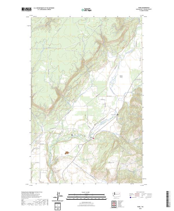
2023 Map of Ford
USGS Topo · Published 2023About this map
Ford serves as a central point of settlement in this part of Stevens County, situated at the junction of several critical regional roads including the Ford-Wellpinit Rd and Reservation Rd. The landscape is defined by the broad expanse of Walkers Prairie and the descending drainage of Chamokane Creek, which receives numerous tributaries like Tshimakain Creek and Mission Creek. These watercourses have historically dictated the placement of early infrastructure and homesteads in the region.
Find a feature on this map
43 named features on this map. Tap any name to fly to it.
Don’t see what you’re looking for? This feature index may not catch every label — zoom into the map to look around manually.
Map Details
Editions of this 2023 Ford Map
This is the sole edition of this map. No revisions or reprints were ever made.
Other maps of this area

1927 · Chewelah
USGS Topo · 1:125,000

1930 · Chewelah
USGS Topo · 1:125,000

1944 · Clayton
USGS Topo · 1:62,500

1944 · Wellpinit
USGS Topo · 1:62,500

1950 · Clayton
USGS Topo · 1:62,500

1953 · Wellpinit
USGS Topo · 1:62,500

1955 · Spokane
USGS Topo · 1:250,000

1958 · Spokane
USGS Topo · 1:250,000

1958 · Sandpoint
USGS Topo · 1:250,000

1963 · Sandpoint
USGS Topo · 1:250,000