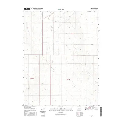
2016 Map of Forder
USGS Topo · Published 2016About this map
Grandma Forgey Grave sits along the section lines in this dry reach of the Colorado High Plains, a poignant reminder of the homesteaders who settled Lincoln County. The small community of Forder marks a primary node in a vast grid of county roads, including Co RD M and Co RD 19, which provide access to isolated farmsteads and ranching sections. The landscape is defined by the ephemeral drainages of Horse Cr and Little Horse Cr, which cut subtle paths through the terrain. Evidence of early settlement patterns remains visible at Spring Hill Cem, providing a focal point for genealogical research in a region where the vastness of the plains often obscures the historical footprint of individual families.
Find a feature on this map
22 named features on this map. Tap any name to fly to it.
Don’t see what you’re looking for? This feature index may not catch every label — zoom into the map to look around manually.
Map Details
Editions of this 2016 Forder Map
This is the sole edition of this map. No revisions or reprints were ever made.
Other maps of this area

1889 · Sanborn
USGS Topo · 1:125,000

1891 · Sanborn
USGS Topo · 1:125,000

1893 · Sanborn
USGS Topo · 1:125,000

1954 · Lamar
USGS Topo · 1:250,000

1958 · Lamar
USGS Topo · 1:250,000

1975 · Stanley Gulch
USGS Topo · 1:24,000

1977 · Walker Point
USGS Topo · 1:24,000

1977 · Punkin Center
USGS Topo · 1:24,000
1978 · Peace Valley
USGS Topo · 1:24,000
1978 · Metz Springs
USGS Topo · 1:24,000