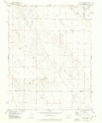
1977 Map of Walker Point
USGS Topo · Published 1978About this map
Walker Point rises as a prominent landmark above the eastern Colorado plains in this 1970s survey. The landscape is defined by the broad expanse of Ninemile Flats, a region marked by its semi-arid drainage patterns and numerous isolated water sources. Intermittent waterways such as Dead Horse Creek and Lone Tree Creek cut through the terrain, while several Springs and individual Spring locations indicate the critical role of groundwater for ranching and livestock in this portion of the High Plains. The map also delineates the jurisdictional boundary between Lincoln and Crowley counties. This topography reveals a high-altitude prairie environment where water is the primary driver of the sparse development pattern, evidenced by the scattered distribution of named wells and water holes across the open range.
Find a feature on this map
8 named features on this map. Tap any name to fly to it.
Don’t see what you’re looking for? This feature index may not catch every label — zoom into the map to look around manually.
Map Details
Editions of this 1977 Walker Point Map
This is the sole edition of this map. No revisions or reprints were ever made.
Other maps of this area

1889 · Sanborn
USGS Topo · 1:125,000

1891 · Sanborn
USGS Topo · 1:125,000

1891 · Catlin
USGS Topo · 1:125,000

1893 · Sanborn
USGS Topo · 1:125,000
1893 · Catlin
USGS Topo · 1:125,000

1954 · Lamar
USGS Topo · 1:250,000

1958 · Lamar
USGS Topo · 1:250,000
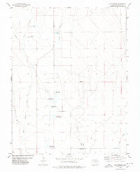
1977 · Box Springs
USGS Topo · 1:24,000

1978 · Cockleburr Springs
USGS Topo · 1:24,000
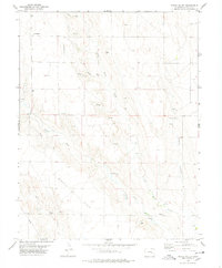
1978 · Peace Valley
USGS Topo · 1:24,000