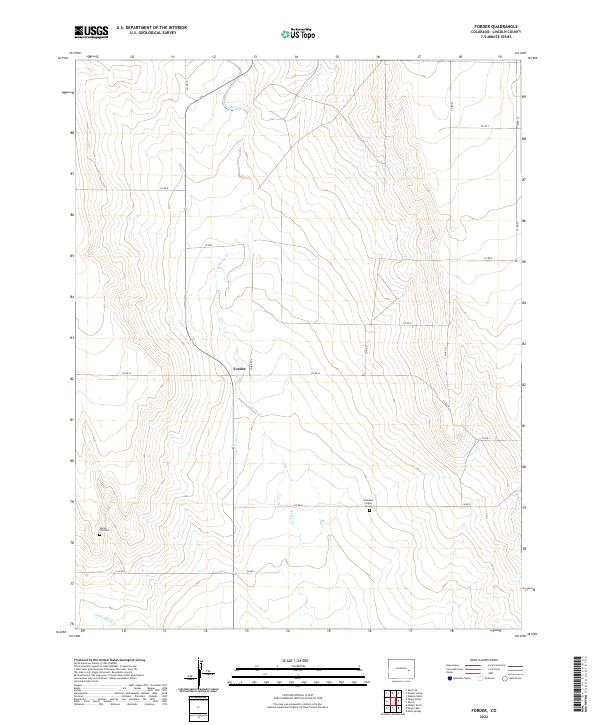
2022 Map of Forder
USGS Topo · Published 2022About this map
Horse Cr and its northern tributary, Little Horse Cr, carve a subtle drainage network through the high plains of Lincoln County. The small settlement of Forder sits at a junction of section-line roads, representing the sparse ranching and farming communities that define this arid Colorado landscape. This modern survey provides crucial detail for family historians, noting specific burial sites often omitted from broader maps. Along Co RD K, the Grandma Forgey Grave serves as a singular, grounded landmark of local heritage, while the Spring Hill Cem to the southwest marks another point of genealogical interest. The grid of county roads, including Co RD 19 and Co RD 24, illustrates the enduring Public Land Survey System structure that continues to organize the rural interior.
Find a feature on this map
22 named features on this map. Tap any name to fly to it.
Don’t see what you’re looking for? This feature index may not catch every label — zoom into the map to look around manually.
Map Details
Editions of this 2022 Forder Map
This is the sole edition of this map. No revisions or reprints were ever made.
Other maps of this area

1889 · Sanborn
USGS Topo · 1:125,000

1891 · Sanborn
USGS Topo · 1:125,000

1893 · Sanborn
USGS Topo · 1:125,000

1954 · Lamar
USGS Topo · 1:250,000

1958 · Lamar
USGS Topo · 1:250,000

1975 · Stanley Gulch
USGS Topo · 1:24,000

1977 · Walker Point
USGS Topo · 1:24,000

1977 · Punkin Center
USGS Topo · 1:24,000
1978 · Peace Valley
USGS Topo · 1:24,000
1978 · Metz Springs
USGS Topo · 1:24,000