Loading...
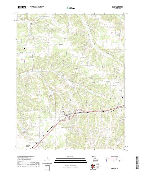
Loading map...2021 Map of Fordland
USGS Topo · Published 2021About this map
Fordland serves as the primary hub of this Webster County landscape, where the local terrain is defined by a series of deep drainages including Meyers Hollow, Burks Hollow, and White Oak Hollow. This modern survey illustrates the persistent rural infrastructure of the region, anchored by historical burial grounds such as Mount Olive Cem and Lea Cem. Water sources are scattered throughout the hills, from the northern Totten Lake to the natural outflow at Cave Spring.
Find a feature on this map
104 named features on this map. Tap any name to fly to it.
Don’t see what you’re looking for? This feature index may not catch every label — zoom into the map to look around manually.
Map Details
Date Portrayed2021
Date Published2021
PublisherU.S. Geological Survey
Map TypeTopographic
Scale1:24000
Physical Dimensions24 x 29 inches
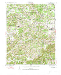
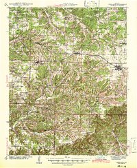
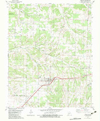
Editions of this 2021 Fordland Map
This is the sole edition of this map. No revisions or reprints were ever made.
Historical Maps of Diggins Through Time
4 maps found
Featured Locations
Source Details
SourceU.S. Geological Survey
CopyrightPublic Domain