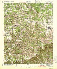
1942 Map of Fordland
USGS Topo · Published 1942About this map
Diggins and Seymour anchor the northern corridor of this region, defined by the path of the St Louis San Francisco railroad and the burgeoning highway network. The landscape is a dense network of township divisions including High Prairie, East Dallas, and Hazelwood, where small agrarian communities supported dozens of local schools such as Mountain Dale Sch and Center Point Sch. Southward, the terrain transitions into the creek valleys of Finley Creek and Swan Creek, where smaller outposts like Olga, Abadyl, and Dogwood appear. This 1942 edition, based on field surveys from the 1930s, documents a high density of rural infrastructure, from the Union Chapel to family-named landmarks like Taylor Cem and Childress Cem, reflecting the early 20th-century settlement pattern before mid-century consolidation transformed the rural school system.
Find a feature on this map
69 named features on this map. Tap any name to fly to it.
Don’t see what you’re looking for? This feature index may not catch every label — zoom into the map to look around manually.
Map Details
Editions of this 1942 Fordland Map
2 editions found
Other maps of this area

1884 · Springfield
USGS Topo · 1:125,000

1886 · Springfield
USGS Topo · 1:125,000

1907 · Forsyth
USGS Topo · 1:125,000

1936 · Ava
USGS Topo · 1:48,000

1937 · Bradleyville
USGS Topo · 1:48,000

1937 · Ozark
USGS Topo · 1:48,000

1939 · Fordland
USGS Topo · 1:62,500

1942 · Fordland
USGS Topo · 1:62,500

1942 · Ava
USGS Topo · 1:62,500

1943 · Ozark
USGS Topo · 1:62,500