
1939 Map of Fordland
USGS Topo · Published 1939About this map
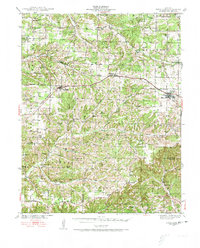
St Louis-San Francisco rails anchor the high ground in the late 1930s, connecting the major ridge-line settlements of Fordland, Diggins, and Seymour. This transport corridor serves as the primary artery through Webster County, while the surrounding landscape is defined by the headwaters of the Finley Creek and its southern descent toward the White River basin. The map reveals an exceptionally dense network of rural infrastructure, including dozens of local schools such as Cave Spring Sch and Pleasant Hope Sch that suggest a populated countryside before mid-century consolidation.
Find a feature on this map
73 named features on this map. Tap any name to fly to it.
Don’t see what you’re looking for? This feature index may not catch every label — zoom into the map to look around manually.
Map Details
Editions of this 1939 Fordland Map
2 editions found
Other maps of this area

1884 · Springfield
USGS Topo · 1:125,000

1886 · Springfield
USGS Topo · 1:125,000

1907 · Forsyth
USGS Topo · 1:125,000

1936 · Ava
USGS Topo · 1:48,000

1937 · Bradleyville
USGS Topo · 1:48,000

1937 · Ozark
USGS Topo · 1:48,000

1942 · Fordland
USGS Topo · 1:62,500

1942 · Ava
USGS Topo · 1:62,500

1943 · Ozark
USGS Topo · 1:62,500

1943 · Bradleyville
USGS Topo · 1:62,500