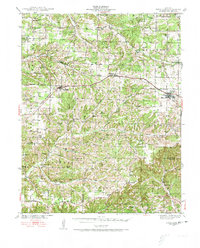
1939 Map of Fordland
USGS Topo · Published 1973About this map
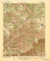
Fordland and Seymour anchor the northern corridor of this 1930s landscape, where the St Louis - San Francisco RR cuts a straight path across the headwaters of the regional river systems. The map captures a transition between the uplands of East Dallas and the creek-cut terrain of East Benton. This era was defined by a dense network of local education and faith, evidenced by numerous rural centers like Cave Spring Sch, Silver Shade Sch, and Mt Olive Ch. To the south, the terrain becomes more varied around Keyger Mtn and the waters of Finley Creek. Smaller communities such as Diggins, Bruner, and Elkhead are shown as active hubs, while landmarks like Finley Falls and Murphy Pond suggest the importance of local water sources. Genealogists can locate family burial grounds including the Winningham Cem and Ragsdale Cem, which served the scattered farming townships during this pre-war period.
Find a feature on this map
78 named features on this map. Tap any name to fly to it.
Don’t see what you’re looking for? This feature index may not catch every label — zoom into the map to look around manually.
Map Details
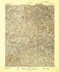
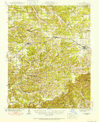
Editions of this 1939 Fordland Map
2 editions found
Other maps of this area

1884 · Springfield
USGS Topo · 1:125,000

1886 · Springfield
USGS Topo · 1:125,000

1907 · Forsyth
USGS Topo · 1:125,000
1936 · Ava
USGS Topo · 1:48,000

1937 · Bradleyville
USGS Topo · 1:48,000
1937 · Ozark
USGS Topo · 1:48,000
1939 · Fordland
USGS Topo · 1:62,500
1942 · Fordland
USGS Topo · 1:62,500
1942 · Ava
USGS Topo · 1:62,500
1943 · Ozark
USGS Topo · 1:62,500