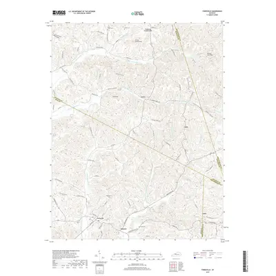
2019 Map of Fordsville
USGS Topo · Published 2019About this map
Fordsville serves as the primary hub in this corner of Ohio County, where the convergence of Adams Fork and W Fork Adams Fork shaped the early development of the surrounding countryside. The landscape is defined by its dendritic drainage patterns, with numerous named branches and forks cutting through the ridges. To the north, the high ground of Turkey Scratch Knob and Bald Knob overlooks a network of rural roads connecting small settlements like Easton, Cabot, and Victoria Crossroads.
Find a feature on this map
88 named features on this map. Tap any name to fly to it.
Don’t see what you’re looking for? This feature index may not catch every label — zoom into the map to look around manually.
Map Details
Editions of this 2019 Fordsville Map
This is the sole edition of this map. No revisions or reprints were ever made.
Other maps of this area

1903 · Tell City
USGS Topo · 1:62,500

1907 · Whitesville
USGS Topo · 1:62,500

1909 · Whitesville
USGS Topo · 1:62,500

1932 · Fordsville
USGS Topo · 1:62,500

1934 · Cannelton
USGS Topo · 1:62,500

1953 · Dundee
USGS Topo · 1:24,000

1953 · Cloverport
USGS Topo · 1:24,000

1953 · Whitesville
USGS Topo · 1:24,000

1953 · Falls Of Rough
USGS Topo · 1:24,000
1953 · Mattingly
USGS Topo · 1:24,000