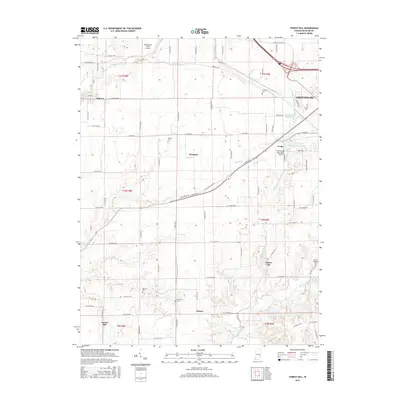
2016 Map of Forest Hill
USGS Topo · Published 2016About this map
Greensburg serves as the focal point in the northeastern corner of this Decatur County landscape, where the town’s reach is marked by Greensburg Reservoir and the Greensburg Municipal Airport. The map documents a predominantly agricultural region defined by a grid of county roads and a network of waterways, including Fall Fork, Clifty Creek, and Muddy Fork Sand Cr. Small, scattered communities like Milford, Harris City, Ewington, and Forest Hill anchor the rural survey sections, many preserving their early heritage through family-named burial grounds such as Mowery Cem and Forsythe Cem. The mapping of small aviation sites like Schoettmer Farm Airport alongside the municipal facilities illustrates the evolving transportation needs of the Indiana countryside. For genealogists and local historians, these detailed boundaries and family-named landmarks provide a clear record of land ownership patterns and rural settlement at the beginning of the twenty-first century.
Find a feature on this map
77 named features on this map. Tap any name to fly to it.
Don’t see what you’re looking for? This feature index may not catch every label — zoom into the map to look around manually.
Map Details
Editions of this 2016 Forest Hill Map
This is the sole edition of this map. No revisions or reprints were ever made.
Other maps of this area

1942 · Columbus
USGS Topo · 1:125,000

1953 · Cincinnati
USGS Topo · 1:250,000

1956 · Waldron
USGS Topo · 1:24,000

1957 · Cincinnati
USGS Topo · 1:250,000

1958 · Greensburg
USGS Topo · 1:24,000

1958 · Millhousen
USGS Topo · 1:24,000

1958 · Westport
USGS Topo · 1:24,000

1958 · Forest Hill
USGS Topo · 1:24,000

1958 · Hartsville
USGS Topo · 1:24,000

1958 · Grammer
USGS Topo · 1:24,000