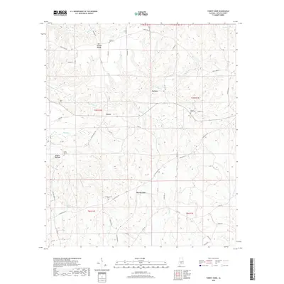
2018 Map of Forest Home
USGS Topo · Published 2018About this map
Forest Home and Butler Springs anchor this portion of Butler County, where small rural settlements are linked by a network of winding roads like Forest Home Rd and Shackleville Rd. The landscape is defined by the headwaters of numerous creeks, including Pine Barren Cr, Redicks Cr, and Brestwork Cr, which carve through the undulating terrain. For those researching local heritage, the map identifies several distinct burial grounds that mark the locations of early community centers, such as Forest Home Cem, Butler Springs Cem, and the more secluded Watts Cem. The presence of smaller locales like Saucer and Shacklesville suggests a historical pattern of decentralized farming communities, many established near reliable water sources like English Pond or the banks of Wolf Cr.
Find a feature on this map
58 named features on this map. Tap any name to fly to it.
Don’t see what you’re looking for? This feature index may not catch every label — zoom into the map to look around manually.
Map Details
Editions of this 2018 Forest Home Map
This is the sole edition of this map. No revisions or reprints were ever made.
Other maps of this area

1953 · Andalusia
USGS Topo · 1:250,000

1957 · Andalusia
USGS Topo · 1:250,000

1971 · Greenville West
USGS Topo · 1:24,000

1971 · Fort Dale
USGS Topo · 1:24,000

1971 · Georgiana East
USGS Topo · 1:24,000

1971 · Bethel
USGS Topo · 1:24,000

1971 · Georgiana West
USGS Topo · 1:24,000

1981 · Pine Apple North
USGS Topo · 1:24,000

1981 · Forest Home
USGS Topo · 1:24,000
1981 · Ridgeville
USGS Topo · 1:24,000