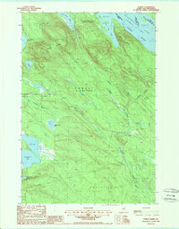
1988 Map of Forest
USGS Topo · Published 1988About this map
The borderlands of eastern Maine and New Brunswick are defined by a complex network of waterways, centered on the Chiputneticook Lakes and the St Croix River. This late-1980s survey captures the settlement of Forest and the surrounding wilderness across Forest City and Codyville Plot. The landscape is dominated by glacial features and timberland, with Greenland Mountain and Spruce Mtn rising above a dense collection of ponds and brooks. Significant water bodies such as Drake Lake, Jackson Brook Lake, and the winding Tomah Stream illustrate the drainage patterns of this remote northern region. A Radio Tower and several scattered Gravel Pit locations indicate the light industrial and communication infrastructure serving these isolated communities near the international boundary.
Find a feature on this map
31 named features on this map. Tap any name to fly to it.
Don’t see what you’re looking for? This feature index may not catch every label — zoom into the map to look around manually.
Map Details
Editions of this 1988 Forest Map
This is the sole edition of this map. No revisions or reprints were ever made.
Other maps of this area

1940 · Danforth
USGS Topo · 1:62,500

1940 · Waite
USGS Topo · 1:62,500

1940 · Forest
USGS Topo · 1:62,500

1941 · Danforth
USGS Topo · 1:62,500

1941 · Scraggly Lake
USGS Topo · 1:62,500

1942 · Waite
USGS Topo · 1:62,500

1942 · Forest
USGS Topo · 1:62,500

1943 · Danforth
USGS Topo · 1:62,500

1944 · Scraggly Lake
USGS Topo · 1:62,500

1957 · Fredericton
USGS Topo · 1:250,000