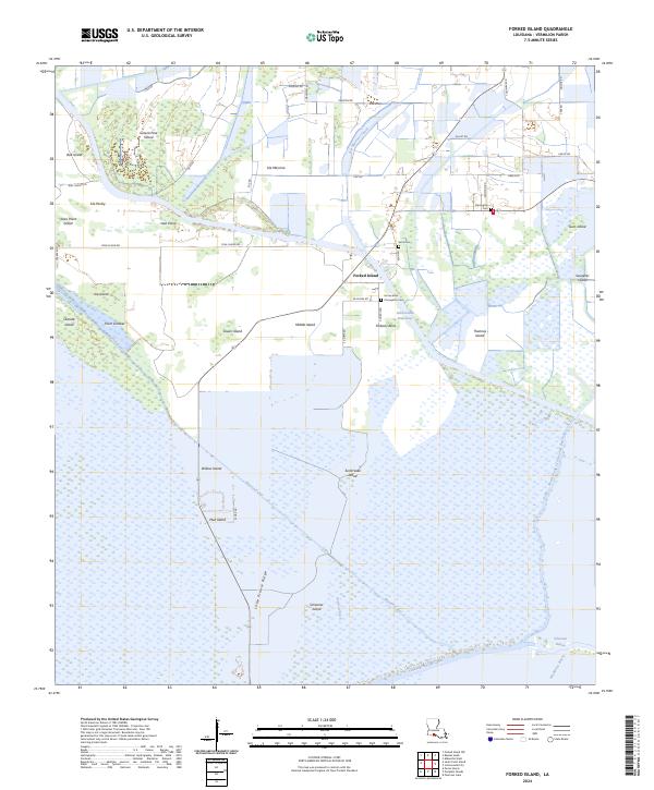
2024 Map of Forked Island
USGS Topo · Published 2024About this map
The low-lying wetlands of Vermilion Parish are defined by an intricate network of marshes and islands, centered around the settlement of Forked Island. The landscape is a complex tapestry of ridges and canals, where Intracoastal Waterway cuts through the terrain near Middle Island and Thannas Island. Further south, the map reveals the isolation of the coastal marsh, punctuated by Little Prairie Ridge and Schooner Island.
Find a feature on this map
61 named features on this map. Tap any name to fly to it.
Don’t see what you’re looking for? This feature index may not catch every label — zoom into the map to look around manually.
Map Details
Editions of this 2024 Forked Island Map
This is the sole edition of this map. No revisions or reprints were ever made.
Other maps of this area

1932 · Abbeville SW
USGS Topo · 1:31,680

1932 · Abbeville NW
USGS Topo · 1:31,680

1945 · Pecan Island NW
USGS Topo · 1:31,680

1945 · Pecan Island NE
USGS Topo · 1:31,680

1946 · Schooner Bayou SE
USGS Topo · 1:31,680

1946 · Schooner Bayou NE
USGS Topo · 1:31,680

1946 · Redfish Point NW
USGS Topo · 1:31,680

1946 · Schooner Bayou NW
USGS Topo · 1:31,680

1946 · Schooner Bayou SW
USGS Topo · 1:31,680

1951 · Pecan Island
USGS Topo · 1:62,500