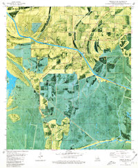
1979 Map of Forked Island
USGS Topo · Published 1980About this map
Forked Island and the surrounding marshlands of Vermilion Parish define this landscape, where land and water merge through an extensive network of drainage and transport canals. The Intracoastal Waterway cuts a straight path through the low-lying terrain, flanked by numerous named topographic rises such as Greens Pine Island, Isle Marrone, and Turtle Lake Island. These slightly elevated "islands" provided the dry ground necessary for settlements like Marrone and Pevley, as well as essential local landmarks like Harrington Cem.
Find a feature on this map
35 named features on this map. Tap any name to fly to it.
Don’t see what you’re looking for? This feature index may not catch every label — zoom into the map to look around manually.
Map Details
Editions of this 1979 Forked Island Map
This is the sole edition of this map. No revisions or reprints were ever made.
Other maps of this area

1932 · Abbeville SW
USGS Topo · 1:31,680

1932 · Abbeville NW
USGS Topo · 1:31,680

1945 · Pecan Island NW
USGS Topo · 1:31,680

1945 · Pecan Island NE
USGS Topo · 1:31,680

1946 · Schooner Bayou SE
USGS Topo · 1:31,680

1946 · Schooner Bayou NE
USGS Topo · 1:31,680

1946 · Redfish Point NW
USGS Topo · 1:31,680

1946 · Schooner Bayou NW
USGS Topo · 1:31,680

1946 · Schooner Bayou SW
USGS Topo · 1:31,680

1951 · Pecan Island
USGS Topo · 1:62,500